
Most trekking guides write about the K2 base camp trek and focus on the destination. They describe K2, the views from Concordia, the feeling of standing at base camp beneath the world’s second highest mountain. All of that is accurate and worth describing. But the trekkers who come back changed by this experience are almost never the ones who went purely for the destination.
What changes people on the K2 base camp trek is the glacier.
Sixty-three kilometres of the Baltoro, the fifth longest non-polar glacier on Earth, running from the snout near Paiju all the way to Concordia where it meets the Godwin-Austen and Abruzzi glaciers in a confluence that has been called the Throne Room of the Mountain Gods since the first Western climbers wrote about it in the late 19th century. Walking on that glacier for eight to ten consecutive days, through a landscape that has no parallel on Earth outside the polar regions, is the experience that stays. K2 at base camp is the exclamation mark at the end of a sentence that the glacier has been writing for the entire second week of the trek.
This guide is for people who are seriously considering the K2 base camp trek in 2026. It goes through everything that actually matters: the honest fitness requirements, the permit and porter system, the day-by-day route, the cost reality, the Concordia experience, the Gilkey Memorial and what it means, and the practical decisions that determine whether this becomes a memory that improves with age or a logistical disaster that teaches hard lessons.
What the K2 Base Camp Trek Actually Is
The K2 base camp trek is a 160 to 186 kilometre return journey through the Central Karakoram National Park in Gilgit-Baltistan, beginning at the village of Askole (3,048 metres) and ending at K2 Base Camp at 5,150 metres above sea level. The standard itinerary runs 18 to 21 days total including travel to and from Skardu and acclimatization days on the glacier.
This is not a teahouse trek. There are no guesthouses, no permanent facilities, no shops, no restaurants beyond Askole. From the moment you leave that village and begin walking into the Braldu Valley, everything you need — food, shelter, cooking equipment, fuel — is carried by a team of Balti porters. The organisational complexity of this system is significant and is one of the reasons the K2 base camp trek cannot practically be done without a licensed operator and experienced local support.
The trek is classified as strenuous. Most days involve 6 to 8 hours of walking, sometimes longer on the glacier sections. The terrain transitions from river valley paths to rocky moraine, then onto the Baltoro Glacier itself where walking on ice and rock debris requires consistent attention and physical endurance. The altitude is serious — K2 Base Camp sits higher than any permanent human settlement on Earth, and the approach through Concordia at 4,690 metres means multiple consecutive days above 4,000 metres before you even reach base camp itself.
What this is not: an Everest base camp equivalent. The Everest base camp trek is a teahouse route with permanent infrastructure, lodge accommodation, and a well-worn tourist path. The K2 base camp trek is a genuine expedition-style journey with no backup infrastructure. This distinction matters enormously for planning and expectation.
The Route: Askole to K2 Base Camp Day by Day
The standard K2 base camp trek itinerary begins after arriving at Skardu by air or road and driving to Askole via the Shigar Valley. The drive from Skardu to Askole takes approximately 5 to 7 hours over a rough jeep track following the Braldu River. Askole, population a few hundred Balti families, is the last village on Earth before the wilderness begins. There are no ATMs, no shops selling gear, no restaurants in the tourist sense. Eat a proper meal in Skardu before you come.
Days 1-2: Askole to Jhola and Paiju (3,420m) The first days follow the Braldu River through a landscape that transitions quickly from the last agricultural terraces of Askole to the stark rock and river terrain of the Karakoram approach. The Trango Towers become visible on day two — sheer granite spires rising to over 6,000 metres from the valley floor, among the most dramatic rock formations in the world. Paiju camp at 3,420 metres is a green area near the Baltoro Glacier snout, often described by trekkers as the last genuinely comfortable campsite before the glacier begins.
Day 3: Acclimatization at Paiju This rest day is not optional. The jump in elevation from Askole to the glacier entry point is significant, and a full day at Paiju for acclimatization walks, gear organisation, and rest determines how the next week of glacier trekking feels. Porters prepare their loads for the glacier. The mountain views from Paiju on a clear day — Trango Towers, Paiyu Peak, the snout of the Baltoro — set the tone for what follows.
Days 4-5: Paiju to Urdukas (4,050m) via Khoburtse The Baltoro Glacier begins. Walking onto the glacier for the first time is disorienting in a specific way — the scale of the ice and debris field stretches to the horizon in ways that make distance judgment almost impossible. The ice beneath the surface moraine is revealed in sections where cleaner ice emerges from the rock covering. The sounds of the glacier — cracking, water running beneath the surface, occasional distant rumbles — are new sensory experiences that take time to normalise.
Urdukas, a rocky outcrop above the glacier at 4,050 metres, is the first campsite on the glacier proper and offers the first wide-angle view of the Baltoro’s full extent. The view from Urdukas in early morning light is one of the genuinely great mountain panoramas on the trek.
Days 6-7: Urdukas to Goro II (4,300m) Two days of glacier walking through increasingly dramatic terrain. The Trango Towers recede. Masherbrum (7,821 metres) appears on the right. The Cathedral spires, the Muztagh Tower, and Chogolisa come into view progressively as you move further up the glacier. The scale of the Karakoram is revealed over these two days in a way that nothing at lower elevations has prepared you for — peaks that appear monumental from a distance take three hours of walking to seem measurably closer.
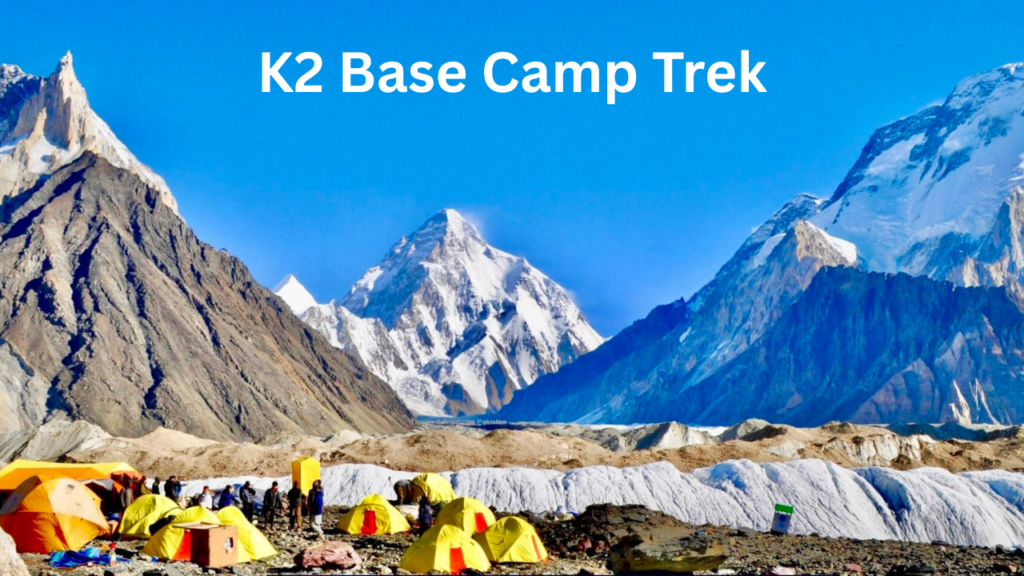
Days 8-9: Goro II to Concordia (4,690m) Arrival at Concordia is the emotional and visual climax of the approach section. The Baltoro Glacier meets the Godwin-Austen and Abruzzi glaciers here in a confluence of ice that creates a natural amphitheatre with a 360-degree view of eight-thousanders. K2 (8,611m), Broad Peak (8,051m), Gasherbrum I (8,080m), and Gasherbrum II (8,035m) are all visible simultaneously from Concordia camp.
The phrase “Throne Room of the Mountain Gods” was coined by photographer and climber Galen Rowell, and it is the rare piece of promotional language that is actually an understatement when you arrive. Most trekkers fall silent for a period upon arrival at Concordia. This is not theatre. It is simply the appropriate response to looking at four of the world’s fourteen eight-thousanders at once, with glaciers stretching in every direction and no trace of human civilisation in any direction except the tents around you.
Two nights at Concordia allow for proper rest and an acclimatization day that includes an optional hike to Broad Peak Base Camp (4,800 metres) for those who want to push higher and see the operating mountaineering camps up close.
Day 10: Concordia to K2 Base Camp (5,150m) and back From Concordia, the Godwin-Austen Glacier leads northeast toward K2. The approach passes the Gilkey Memorial at approximately 4,968 metres — a stone cairn covered in metal plaques commemorating mountaineers who have died on K2, 94 names as of November 2025. Standing at the Gilkey Memorial is not a comfortable experience, and it is not supposed to be. The plaques are inscribed with names, nationalities, and dates. Some are from recent seasons. The mountain above you is still killing people. This combination of beauty and mortality is the emotional centre of the K2 base camp trek, and the trekkers who spend genuine time at the memorial rather than treating it as a photo stop come away from the experience changed in a specific way.
K2 Base Camp itself is the site of the operational mountaineering camps during the summer climbing season. In July and August, international expeditions are preparing for summit attempts. The tents, the equipment, the controlled chaos of a high-altitude mountaineering operation seen at close range — this is a different world from any trekking destination, and the access that the K2 base camp trek provides to it is genuinely unique.
Days 11-16: Return via the same route The return follows the same glacier route in reverse. Most trekkers find the return psychologically different from the approach — the peaks are now familiar, the body is acclimatised and stronger, and the glacier that was intimidating on the way up has become a known terrain. Some itineraries include a night at Broad Peak Base Camp on the return, and many include an alternative descent variation through the Gondogoro La pass for those who have arranged the additional permits and are up for the challenge.
The Gondogoro La Extension: For Those Who Want More
The Gondogoro La is a high mountain pass at 5,585 metres that provides an alternative return route from Concordia into the Hushe Valley, completing what is sometimes called the K2 Concordia Gondogoro La circuit. This extension adds 3 to 5 days to the trek and crosses glacier terrain at altitude that requires crampons, ice axes, and technical guidance from your mountain guide.
The reward for this extension is significant: the view from the top of Gondogoro La shows K2, Broad Peak, Gasherbrum I, and Gasherbrum II simultaneously in a 360-degree panorama that trekkers consistently describe as the single best mountain view of the entire trip. The descent into the Hushe Valley is dramatic and the exit through Khaplu and Skardu is a genuinely different landscape from the approach through Askole.
Gondogoro La is not for everyone. It requires a genuine level of alpine fitness and comfort with glacier travel, and the additional altitude and technical terrain carry real risk for trekkers who push beyond their physical capacity. Your mountain guide’s honest assessment of whether your group should attempt it deserves full weight.
Permits, Regulations, and What They Cost in 2026
The K2 base camp trek traverses the Central Karakoram National Park (CKNP), which requires a national park entry permit. As of early 2026, trekking permits for the Baltoro region and CKNP are managed through licensed operators only — independent trekking without a registered guide and permit is not permitted.
The government permit fee for the Baltoro route runs approximately USD 150 to 300 per trekker, depending on the permit category and whether the Gondogoro La extension is included. This is paid through your licensed operator as part of the overall package or separately arranged if you are using an independent guide service.
Foreign trekkers require a Pakistan visa, which is available as an e-visa from the official Pakistan e-visa portal. The process is straightforward for most nationalities. Allow at least two weeks for processing.
A licensed mountain guide is mandatory on the K2 base camp trek. Gilgit-Baltistan requires all trekking groups in the CKNP to be accompanied by a registered guide. This is not bureaucratic overhead — the Baltoro Glacier route requires navigation skills, weather judgment, and emergency decision-making capacity that only experienced local guides with specific knowledge of this terrain reliably possess.
Porters: The System That Makes the Trek Possible
The Balti porter system is the logistical backbone of the K2 base camp trek, and understanding it before you go makes the experience significantly better.
Balti porters from Askole and surrounding villages have been the workforce of Karakoram expeditions since the first Western mountaineers arrived in this region in the 1880s. They carry loads of approximately 25 kilograms each over glacier terrain that would challenge most trekkers carrying nothing but a daypack. Their route knowledge, their physical capacity at altitude, and their familiarity with the specific hazards of the Baltoro are irreplaceable by any technological substitute.
The standard 2026 porter wage for the Baltoro route is approximately USD 20 to 25 per day, plus equipment (boots, gloves, sunglasses, and appropriate clothing that many operators provide), food, and a porter insurance payment required by government regulation. This insurance, often Rs. 3,000 to 5,000 per porter, covers medical evacuation costs for porters injured on the trek. It is paid by the operator and passed to the trekker as part of the overall cost.
The number of porters required depends on group size. A solo trekker or couple with a licensed operator will have a minimum of four to six porters plus a guide. Larger groups scale accordingly. This is not an area where cost-cutting makes sense — underpaying or underequipping porters is both ethically wrong and practically counterproductive since the porter strike history on Karakoram treks is well-documented and results from exactly these conditions.
Tip your porters. The minimum generally cited is 10 percent of the total trip cost distributed between the team. Porters who work well deserve recognition and the tipping culture on this trek has a direct impact on the livelihood of Askole and Khaplu families who depend on this income seasonally.
Cost: What the K2 Base Camp Trek Actually Costs in 2026
This is the question that everyone asks and most guides answer vaguely. Here are the actual 2026 numbers.
Pakistani national, independent arrangement with local operator: Rs. 350,000 to 600,000 per person for a 18-20 day trek including guide, porters, camping equipment, all meals on trek, Skardu hotel, jeep transfers, and permits. This range reflects the variation between budget local operators and more established companies with better equipment and guide qualifications.
International trekker, international operator package: USD 1,550 to 4,500 per person. The lower end represents packages from reputable local operators like Skardu Trekkers who offer all-inclusive trekking from $1,550. The upper end reflects international adventure travel companies that add significant overhead for their brand, international marketing, and western-standard camping setups.
What is NOT included in most packages: International flights to Islamabad, Pakistan visa fee, meals in Islamabad and Skardu before and after the trek, personal trekking gear, tips for guides and porters (minimum 10 percent), medical and evacuation insurance (minimum USD 25,000 coverage recommended — this is non-negotiable for this trek), and any drone or special filming permit if you plan to bring camera drones into the CKNP.
The single biggest variable cost: Skardu flights. If your Islamabad to Skardu flight is cancelled (which happens regularly due to weather on this mountain route), the road alternative adds 12 to 16 hours and potentially an extra hotel night. Budget for this possibility.
Fitness: The Honest Assessment
The K2 base camp trek is described as “strenuous” in every guide that uses responsible language. Here is what that actually means for planning purposes.
You will walk 6 to 8 hours per day for 12 to 14 consecutive trekking days, at elevations ranging from 3,000 to 5,150 metres, over terrain that includes rocky valley paths, loose moraine, and glacier ice. The cumulative fatigue of doing this day after day is the primary physical challenge, rather than any single day’s difficulty.
Preparation that actually works: six months of consistent cardiovascular exercise including long-duration hiking with a weighted pack. Three months before the trek, weekend hikes of 6 to 8 hours with 10 to 15 kilogram pack weight on variable terrain will give you the most relevant conditioning. Gym fitness without endurance hiking specifically is insufficient preparation — the movement patterns of trekking with a load over variable terrain are different from gym cardio and need to be trained separately.
Altitude is the variable that fitness cannot fully compensate for. Most trekkers experience some degree of altitude symptoms on the Baltoro route regardless of their fitness level. The acclimatization days built into the itinerary address this systematically. Do not skip them, do not argue with your guide about them, and do not let summit fever push you past warning signs.
People have died on the K2 base camp trek from acute mountain sickness and high altitude cerebral and pulmonary edema. These are conditions that develop quickly and require immediate descent when symptoms appear. Your guide will know the signs. Listen to them.
The Gilkey Memorial: What It Means and Why It Matters
The Gilkey Memorial deserves more space than most K2 base camp trek guides give it.
Named after Art Gilkey, the American geologist who died on K2 during the 1953 American expedition, the memorial began as a simple stone cairn and has grown over seven decades into a stone-and-metal structure covered with plaques commemorating 94 climbers who have died on K2 and neighbouring peaks, as of November 2025. The plaques are added informally by subsequent expeditions. There is no official management, no governing body, no formal process. Teams that arrive at base camp and know of a colleague’s death on the mountain add a plaque. Balti porters maintain the structure during their regular passages.
The Gilkey Memorial is located at approximately 4,968 metres, just below K2 Base Camp, on a rocky outcrop above the Godwin-Austen Glacier. Standing there requires understanding what K2 actually is: the most dangerous of the fourteen eight-thousanders by fatality rate. Approximately one person has died for every four who have reached the summit. The plaques at the memorial are not historical artefacts. Several are from the last few years. The mountain above you was killing professional mountaineers in 2023 and 2024. The scale and beauty of what you can see from the memorial is in direct conversation with the danger represented by the structure you are standing next to.
This is the emotional core of the K2 base camp trek in a way that no amount of landscape photography captures. The experience of reading names on the plaques at 4,968 metres with K2 filling the sky above you is unlike anything available at any other trekking destination in the world.
Best Time for the K2 Base Camp Trek in 2026
The trekking season on the Baltoro runs from mid-June to late September.
June (mid-month onward): Accessible but with residual snow on upper glacier sections and around Concordia. Quieter than July-August. Operators who prefer June departures cite smaller groups and more pristine snow conditions. The trade-off is colder temperatures and the possibility of slower going through snow-covered sections.
July to mid-August: Peak season. Longer daylight hours, stable glacier access, and the most active mountaineering season at base camp. International expeditions attempting K2 summit bids are at maximum activity during this window, and the base camp experience includes witnessing operational high-altitude mountaineering at close range. The glacier is at its most accessible. Weather is most variable — clear mornings, afternoon cloud and possible light precipitation are typical.
Late August to September: The climbing season winds down, temperatures begin dropping, and the upper glacier sees early autumn conditions. Some trekkers prefer this window for the quieter base camp and the autumn light. By late September the glacier conditions deteriorate and most operators do not depart after the first week of October.
The Gilgit-Baltistan Tourism Department publishes current season advisories and permit information that should be checked before confirming any 2026 departure dates, as conditions and regulations can change between publication of this guide and your travel date.
What to Pack: The Non-Negotiable List
This is not a comprehensive packing list. It is the items that people consistently wish they had brought more of or brought better versions of on the K2 base camp trek.
Footwear: Waterproof trekking boots with ankle support, broken in over at least 50 hours of hiking before the trek. Not new. Not borrowed. A second pair of lighter approach shoes or camp shoes for around camp. Waterproof gaiters for the glacier sections.
Sleeping bag: Rated to minus 15 degrees Celsius minimum. The nights at Concordia and K2 Base Camp are genuinely cold even in July. A sleeping bag that was adequate for a previous high-altitude trek in warmer conditions is not reliable here.
Layers: The base layer, mid layer, insulating layer, hardshell system is standard and correct. The specific item most trekkers underpack is the insulating layer — a proper down jacket rated to minus 10 or below, not a lightweight puffer suitable for city winters.
Sun protection: The UV intensity at glacier elevations reflects off ice and reaches levels that sunburn exposed skin in under an hour. Sunscreen SPF 50 or above, glacier glasses with side shields, a sun hat, and sun gloves for the glacier sections. Glacier blindness from UV exposure on the Baltoro is documented and preventable.
Trekking poles: Non-negotiable on glacier terrain with a loaded pack. Adjust for downhill use (shorter) and uphill (longer). Bring spare tips.
Medical kit: Diamox (acetazolamide) for altitude sickness prevention, prescribed and discussed with your doctor before departure. Anti-diarrheal medication. Blister management supplies. A comprehensive first aid kit is provided by most operators, but personal medications and prescription items are your responsibility.
How the K2 Base Camp Trek Connects to the Wider Pakistan Travel Circuit
The K2 base camp trek sits at the top of the northern Pakistan adventure pyramid. Most trekkers who do it have already built their northern Pakistan experience in stages.
Skardu is the base for the K2 base camp trek and is worth giving real time to before and after. The city has its own character, its own food, and its own surrounding attractions. Our Skardu in summer vs winter comparison covers the full Skardu picture including Deosai National Park access, Shangrila Lake, and Kharpocho Fort — the experiences that make Skardu worth more than one or two transit nights.
Hunza Valley is the natural pre-trek destination for anyone approaching from the north along the KKH. The Hunza apricot season covers the valley’s two distinct seasonal characters — the spring blossom and the summer harvest — both of which overlap meaningfully with K2 trek departure windows.
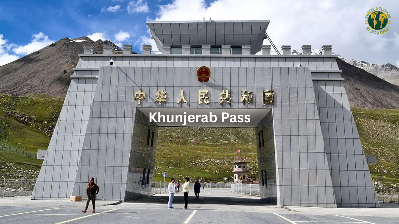
Khunjerab Pass at the northern end of the KKH is the other Hunza-based extension that many K2 trekkers add to the northern circuit before heading south to Skardu for the Askole approach.
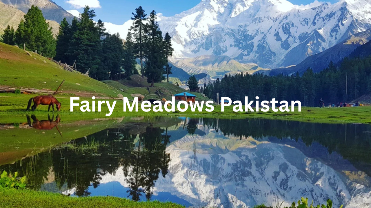
Fairy Meadows Pakistan offers the closest parallel experience to the K2 base camp trek in terms of standing beneath an 8,000 metre face — Nanga Parbat’s Rakhiot face as seen from the meadow. It is considerably more accessible than the K2 trek and serves many trekkers as the introduction to Karakoram-scale mountain views before committing to the full Baltoro expedition.
Chitral offers a different dimension of the northern Pakistan experience altogether. Our Chitral guide covers the Kalash Valleys, Shandur Pass, and Tirich Mir — the Hindu Kush counterpart to the Karakoram experience of the K2 trek.
For those building the full northern Pakistan circuit, our winter travel in Northern Pakistan piece gives context on how these same landscapes transform in the cold months — useful for understanding the seasonal extremes that define everything from the trek window to the porter system.
Islamabad is where every K2 base camp trek begins and ends, and the capital deserves more than a transit stop. Most trekkers arrive jet-lagged and leave exhausted but transformed — the city between those two states offers more than most people expect.
The drive from Lahore to Islamabad at the beginning of a northern Pakistan trip, on the M2 motorway, passes through food stops that deserve their own preparation. Our guide to the best dhabas on the Lahore Islamabad motorway covers exactly what to eat at Bhera and Kallar Kahar on that drive.
For a broader view of Pakistan’s hidden travel character — the destinations and experiences that fall outside the main northern tourist circuit — our Pakistan hidden food gems itinerary provides useful context for understanding the country that the K2 base camp trek sits within.
The K2 base camp trek is the kind of journey that people spend years planning and decades talking about. If you have done it and want to add something to this guide, correct something, or simply share what it was like at Concordia on the morning the clouds cleared, the comments section exists for exactly that. The best information about this trek always comes from people who walked it recently, not guides written in advance of your season.